Fig. 1 Subsidence-rate contour lines derived from HoustonNet GPS observations from 2019 to 2023.
Houston Net
Information about Houston Net
2024 HoustonNet Data Release
HoustonNet processes GPS data for the Harris-Galveston Subsidence District, covering approximately 250 permanent GPS stations across the greater Houston area.
The East-North-UpDown time series data with respect to the Stable Houston Reference Frame (HRF20) and the IGS14 reference frame, spanning from 1993 to 2023, are
compiled in the file named "HoustonNet_2024_Data_Release.tgz" (click to download).
The data process methods are addressed in the following files:
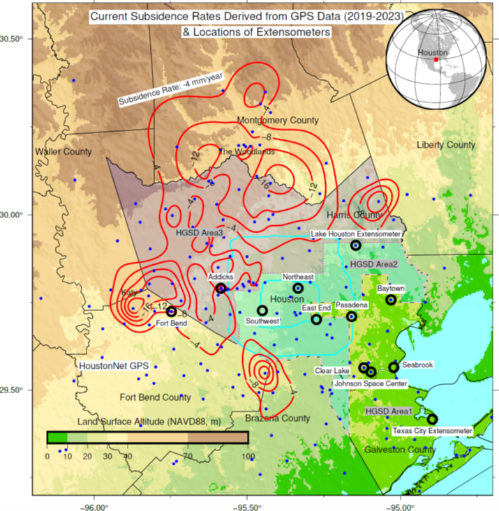
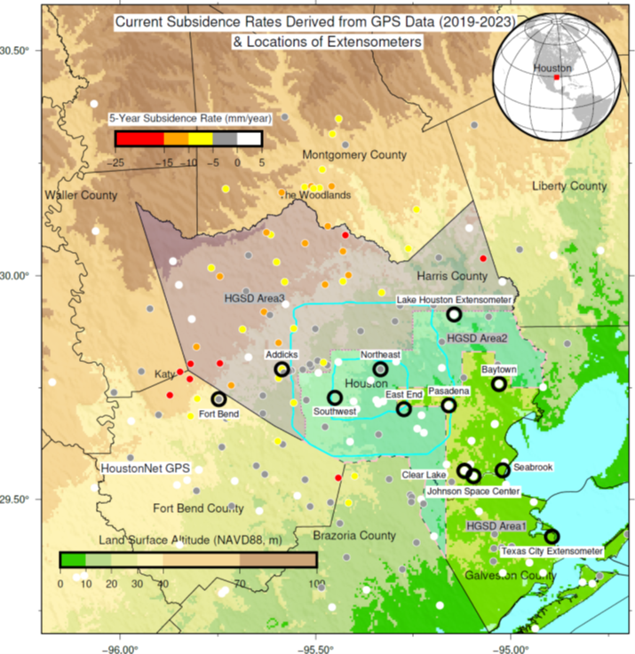
Fig. 2: Five-year average subsidence rates at HoustonNet GPS sites (2019-2023). Gray dots represent sites approaching subsidence cessation, while white dots denote sites experiencing rebound.
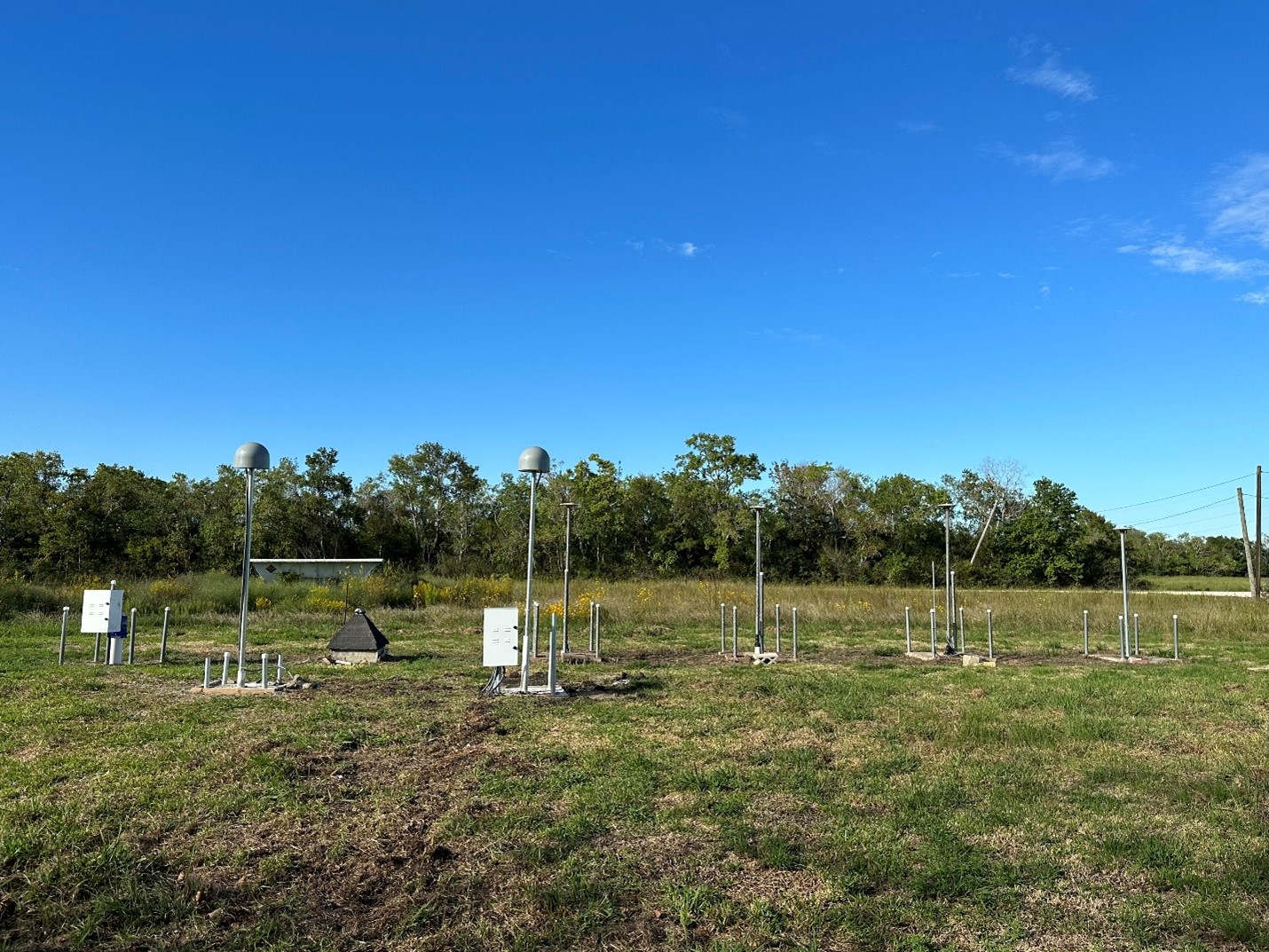
Fig. 3 University of Houston Coastal Center GPS Array: UHC0, UHC1, UHC2, UHC3, UHC4, and UHC5. UHC4 and UHC5 were installed in October 2024.
